Cristobal Batters Mexico Before Heading North to Gulf Coast

[Ensure you have all the info you need in these unprecedented times. Subscribe now.]
Tropical Storm Cristobal brought heavy rain to southern Mexico June 3, and with a forecast that has it re-entering the Gulf of Mexico within a day, oil-platform workers are already being evacuated.
The storm is expected to track north toward the coastline between Texas and the Florida panhandle starting on June 4. In the meantime, it’s carrying winds as high as 60 miles (97 kilometers) per hour and rain that could reach 30 inches (76 centimeters) to Mexico, Guatemala and Belize, said Paul Walker, a meteorologist with AccuWeather Inc. in State College, Pa.
“That is a significant storm,” Walker said. “It probably stays over land mostly through tomorrow,” where it will lose strength before re-entering the Gulf.

Energy prices are already reacting in the U.S. Cristobal could push the average retail price of a gallon of gasoline over $2, according to AAA. Cash gasoline at Houston rose on June 3 as traders secured supply ahead of the storm.
Blendstock on the Colonial Pipeline, the nation’s largest conduit for gasoline, rose half a cent against futures in morning trading.

How can trucking companies adjust to ensure that essential freight keeps moving while protecting their workers from coronavirus? Host Seth Clevenger speaks with Lilli Chiu of Hub International and Dave Cox of Polaris Transportation. Hear a snippet, above, and get the full program by going to RoadSigns.TTNews.com.
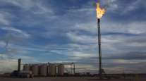
Storms in the Gulf are closely watched by the energy industry because offshore platforms account for 16% of U.S. crude oil production and 2.4% of natural gas production, according to the Energy Department. Additionally, more than 45% of U.S. refining capacity and 51% of gas-processing capacity is located on the coast.
Even a weak system can force evacuations and temporary shutdowns.
Hurricane Chance
The forecast isn’t yet clear for the U.S. coast. There’s a chance Cristobal could reach hurricane strength, which entails winds of 74 mph or more, depending on how it fares after swinging back into the Gulf, Walker said. Storms need warm ocean water to grow stronger, and weaken without it.
On its current track, Cristobal would make U.S. landfall somewhere between Houston and Pensacola, Fla., according to the U.S. National Hurricane Center. The storm is expected to have top winds of at least 65 mph as it nears the U.S. late June 7, early June 8, the center reported.
After coming ashore in Mexico June 3, Tropical Storm Cristobal will turn around and head to the U.S. Gulf of Mexico shoreline.
Cristobal is the third major storm to form in the Atlantic this year, marking the fastest start to hurricane season on record.
If it holds its strength and lands along the Gulf Coast, it will be the second storm to strike the U.S., even though the season will officially only be a week old. If it manages to reach hurricane status, it would be the earliest such a powerful storm to hit the U.S., breaking the old mark set by Hurricane Alma on June 9, 1966, according to Accuweather.
Want more news? Listen to today's daily briefing:
Subscribe: Apple Podcasts | Spotify | Amazon Alexa | Google Assistant | More


