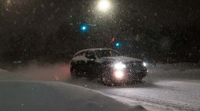
Ice Storm Cuts Power, Scraps Flights, Coats Roads

[Stay on top of transportation news: Get TTNews in your inbox.]
More than 800,000 homes and businesses across the upper Midwest were in the dark on the morning of Feb. 23 after a dangerous ice storm coated roads and knocked down power lines.
More than a half-inch of ice accumulated in some areas, especially in Michigan where most of the power outages occurred, according to PowerOutage.us. About 780 U.S. flights have been canceled Feb. 23, including 25% of the daily schedule at Minneapolis-St. Paul International Airport.
Winter storm warnings and watches stretch from northern Nebraska to Maine, and blizzard warnings remain in effect in Minnesota and the Dakotas.
While the storm is now heading through New York and New England, officials are warning residents to be careful on the roads. Schools are closed in some parts of Michigan and Wisconsin Gov. Tony Evers declared an energy emergency, which gives utilities more flexibility while they work to restore service.
“There is still some lingering threat from ice warnings and watches,” said Frank Pereira, a meteorologist with the National Weather Service. “By early Friday, the last of it moves offshore.”
As the Northeast faces another day of snow, the Southeast will see record heat Feb. 23. An unusual high-pressure system in the region is allowing warm air from higher in the atmosphere to sink closer to the surface, boosting temperatures.
New Orleans is expected to reach 84 degrees, a record for the day, according to Accuweather Inc. Temperatures in Washington, D.C., were forecast to get as high as 82, which would surpass the record for the day of 78 that dates to 1874, while Atlanta was expected to get to 78.
We are still on track for our DANGEROUS winter storm. Expect blizzard conditions in the mountains with FEET of snowfall. A few inches of rain are expected in lower elevations. Be weather ready! #CAwx #LArain #LAsnow #blizzard pic.twitter.com/HbUn08J2qQ — NWS Los Angeles (@NWSLosAngeles) February 23, 2023
As the Midwest storm winds down over the next day, another system is beginning to batter the West Coast, bringing unusually cold temperatures. Parts of Southern California may receive as much as 7 inches of rain through Feb. 25, and snow may fall as low as 1,500 feet. Higher elevations may see as much as 7 feet of snow.
And as that storm moves out to the Rocky Mountain region, there’s a third system that’s lined up to pummel the West Coast over the weekend.
“There’s a lot going on,” said Pereira. “It’s a parade of storms.”
— With assistance from Mary Schlangenstein.
Want more news? Listen to today's daily briefing below or go here for more info:


