Tropical Storm Barry in Gulf of Mexico Barrels Toward Louisiana

[Stay on top of transportation news: Get TTNews in your inbox.]
Tropical Storm Barry formed in the Gulf of Mexico and could strike Louisiana as a hurricane July 13, potentially causing almost $1 billion in damage and worsening flooding in New Orleans.
The system, which was about 90 miles south of the Mississippi River’s mouth as of 5 p.m. EDT July 11, has already curbed about half the energy output in the Gulf of Mexico and helped lift oil prices to a seven-week high. It’s also prompted Louisiana Gov. John Bel Edwards to declare a state of emergency, while hurricane and tropical storm warnings and watches are in place along the state’s coastline.
The storm — with current top speeds of 40 miles an hour — may drop as much as 20 inches of rain in some places, according to an advisory from the U.S. National Hurricane Center. It was moving west into the heart of offshore energy production. Ship traffic was disrupted in the Mississippi River, where water levels may reach the highest in 90 years. Companies have cut 32% of oil and 18% of natural gas output in the Gulf.
JUST IN: Tropical Storm Barry has formed in the Gulf of Mexico with winds of 40 MPH. Barry is expected to strengthen by later today, potentially becoming a hurricane by late Friday into early Saturday. https://t.co/L9kqPBjBOe pic.twitter.com/it0CCcV0kI — ABC News (@ABC) July 11, 2019
“The slow movement of the system will result in a long duration heavy rainfall threat along the central Gulf Coast and inland through the Mississippi Valley through the weekend and potentially into early next week,” U.S. Senior Hurricane Specialist Jack Beven wrote in a forecast analysis. “Flash flooding and river flooding will become increasingly likely, some of which may be significant, especially along and east of the track.”
Gulf of Mexico operators have shut-in 602,715 barrels a day of oil production ahead of the storm, the Bureau of Safety and Environmental Enforcement said in a notice. Almost 500 million cubic feet a day of natural gas production is also closed.
The Gulf offshore region accounts for 16% of U.S. crude oil output and less than 3% of dry natural gas, according to the Energy Information Administration. More than 45% of U.S. refining capacity and 51% of gas processing is along the Gulf coast.
While the offshore platforms could return to normal operations in a few days, there is a chance widespread flooding could close some refineries and make it difficult for ships to make deliveries across the region, Jim Rouiller, chief meteorologist at the Energy Weather Group near Philadelphia, said by telephone.
“The first impact is to the rigs and platforms, then the second risk shows up July 12 and July 13 to the refinery areas,” Rouiller said. “The thing that is going to be really worrisome is the amount of flooding rains across Louisiana. I think the worst is yet to come.”
Update: Here are the 10 AM CDT Key Messages on Tropical Storm #Barry, expected to bring dangerous storm surge, wind and rainfall impacts to portions of the Gulf Coast. See https://t.co/tW4KeFW0gB and https://t.co/SiZo8ohZMN for more information. pic.twitter.com/njn6ty8FLV — National Hurricane Center (@NHC_Atlantic) July 11, 2019
Based on its current track, the storm will likely cause just under $1 billion in flood damage, said Chuck Watson, a disaster modeler with Enki Research in Savannah, Ga.
The storm could push a 3- to 6-foot storm surge up the lower Mississippi, raising the river to its highest levels in 90 years, according to the National Weather Service. “It would be the highest modern day level,” said Jeff Graschel, service coordination hydrologist with the Lower Mississippi River Forecast Center in Slidell, La.
Shipping began grinding to a halt along the southern reaches of the Mississippi River as deteriorating weather conditions made it unsafe for river pilots to board and steer cargo ships. To the west, the U.S. Coast Guard declared “condition X-ray” at Lake Charles, La., and other ports, a warning that gale-force winds are expected within 48 hours.
The heavy rains could hurt cotton crops in southern portions of the Mississippi Delta, said Don Keeney, a meteorologist with Maxar in Gaithersburg, Md.
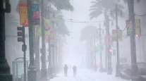
Thunderstorms already have flooded New Orleans streets and the National Weather Service has issued a flash flood watch from southern Louisiana to the Florida panhandle. City pumps had trouble keeping up with the water, which is a “bad sign,” said Enki Research’s Watson.


